
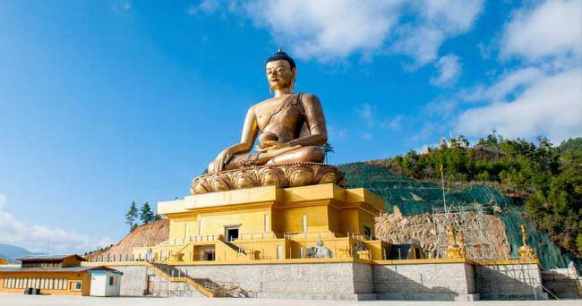
Overview
The Laya-Gasa Trek is considered one of the most scenic treks in Bhutan, offering amazing views of some of the most pristine and unspoiled landscapes in Bhutan. This fourteen day, 217 km journey begins at Drukgyel in Paro and takes you through gorgeous alpine meadows, high mountain passes and dense sub-tropical jungles before terminating in Damji in Tashithang.
The first five days of this trek follow the same route as the Jomolhari Trek I through Jigme Singye National Park and offer awe-inspiring views of Mt. Jomolhari, Jichu Drake and Tsherimgang. On the sixth day the path diverges and you will depart Lingshi for the camp site at Chebisa, a charming little village adorned with a beautiful waterfall of crystal clear water.
Along the trail you’ll be able to spot indigenous animals such as blue sheep and Takins, the national animal of Bhutan. You’ll travel through remote mountain villages inhabited by Layaps (people of Laya), a distinct segment of the Bhutanese society with unique culture, traditions and appearance. Thhe trek also offers a day of relaxation at the famous Gasa hot springs that is sure to rejuvenate you.
This is one of the more difficult treks offered in Bhutan due to the high altitudes and steep ascents and descents along the path. The best seasons to complete this challenge are in April-June and Mid-September-Mid-November.
Highlights
- Tour Duration: 4 Days/ 3 Nights
- Distance Covered: Gunitsawa village, Sharna Zampa
- Meal Plan: MAP
Itinerary
40mins, 80 m descent, camp altitude 2,850 m.
This trek begins at Gunitsawa Village were you pass the army post. At the army checkpost your trek permit (provided by your tour operator) will be checked and endorsed. The campsite is on the opposite side of the river, not far from Gunitsawa.
Distance 22 km, 7-8 hours, 770 m ascent, 10 m descent, camp altitude 3,610 m.
On this long day, the trail continues with lots of small ups and downs. After going uphill through the river valley the valley finally narrows gradually to a mere path which descends to a meadow where a camp will be set up. From here, if weather permits, you will have the first great view of Mt. Jomolhari.
Distance 19 km, 5-6 hours, 480 m ascent, camp altitude 4,080 m.
If you did not see Mt. Jomolhari the previous evening, you will still have a chance to get a great view early this morning. This morning the trek continues up the Paro Chhu valley which widens into patches of alpine meadow and scanty growths of forest. You will cross an army checkpoint along the way and enjoy a spectacular view of high mountain ridges and snow-capped peaks. In this area yaks and their herder’s homes become a regular feature of the landscape. Passing the villages Soe, Takethang and Dangochang is another asset on this day. After reaching Jangothang, one of the most beautiful campsites of the Himalayas, you will again have a spectacular view of Mount Jomolhari.
The rest day in Jangothang provides plenty of possibilities for day hikes with great views of lakes and snow capped mountains such as Jomolhari and Jichu Drake. There are good chances to spot some blue sheep on the upper slopes of the valley. Jangothang is a perfect environment for your acclimatization. You can also trek up to Tosoh or hike around the area. There are good short hiking trails in three directions. Jomolhari and its subsidiary mountain chains lie directly west, Jichu Drake to the north and there are a number of unclimbed peaks to the east.
Inclusion & Exclusion
- Airport Transfers
- Stay in hotels as indicated in the itinerary
- All three meals, tea and coffee
- Dedicated SUV vehicle with a driver and
- English Speaking Guide throughout the Trip
- Short hikes, Packed lunches and snacks wherever required
- Monumental Fees
- Bhutan Tourism Development Fee
- VISA processing Fee
- International Air fare
- Refreshments and bottled drinks and alcohol
- Tips/gratuities
- Cost arising out of Flight Cancellation/road blockades/ landslides and events beyond our control
- Expenses of personal nature and any other expenses not mentioned in the above cost